The ISPRS SC Webinar Series
Collaborative Humanitarian Mapping with PoliMappers and UN Mappers

by Maria Antonia Brovelli, Chiara Ponti, Michael Montani
The webinar consists in two parts:
a “theoretical” part with an introduction to the Collaborative Humanitarian Mapping and OpenStreetMap, the ecosystem that can be used for this purpose, to PoliMappers, the Association of Mappers of Politecnico di Milano and to UN Mappers, the community of UN Mappers;
a “practical” part with a mapathon (map marathon) where we will map together for one of the United Nations Mappers projects. During the mapping activity, participants will learn how to edit data on OpenStreetMap and provide geospatial support to UN Peacekeeping missions. The activity will involve the mapping of the road network in African countries following a step-by-step approach. Please, ensure to have a mouse and good Internet connection.
Aim of the webinar is to learn how we can contribute individually or as a team of students to the Collaborative Humanitarian Mapping process.
Detailed Program:
2:15-2:40 pm OSM and collaborative mapping (Maria A Brovelli)
2:40-2:50 pm Introduction to PoliMappers, the YouthMappers Chapter of Politecnico di Milano (Chiara Ponti)
2:50-3:00 pm UN Mappers (Michael Montani)
3:00-3:15 pm break
3:15-4:00 pm Mapping with UN Mappers (Michael Montani)
Speakers

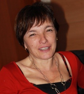
Maria Antonia Brovelli is Professor of GIS at the Politecnico di Milano (PoliMI) and member of the School of Doctoral Studies in Data Science at “Roma La Sapienza”. She is the chair of ISPRS WG IV/4 “Collaborative crowdsourced cloud mapping (C3M)”; member of ESA ACEO (Advisory Committee of Earth Observation); co-chair of the United Nations Open GIS Initiative, Chair of the UN-GGIM (Global Geospatial Information Management) Academic Network, mentor of the PoliMI Chapter of YouthMappers (PoliMappers).

Chiara Ponti is the President and one of the founding members of PoliMappers. She is enrolled in the MSc in Environmental Engineering at Politecnico di Milano and is currently working on her thesis about satellite data processing for mean dynamic ocean topography models.

Michael Montani graduated in Geoinformatics Engineering at the Politecnico di Milano. He is a Senior GIS Consultant at United Nations Global Service Centre (UNGSC). He is Crowdsourcing Manager for the UN Mappers activities. Formerly, he has been Co-founder and President of PoliMappers and YouthMappers Research Fellow, modelling an endemic disease in Senegal with collaborative mapping and AI.
Relevant links:
OpenStreetMap is a free and editable map of the whole world that is being built by volunteers and released with an open-content license. The OpenStreetMap (OSM) project was born in 2004 to encourage the development and distribution of free geospatial data for anybody to edit, use, and share. https://www.openstreetmap.org/
YouthMappers is a worldwide international network of 219 university-student-led chapters. It organizes, collaborates, and implements mapping activities that respond to actual development needs around the globe - creating and using geospatial data and information that is made publicly available through open platforms. https://www.youthmappers.org/
PoliMappers is a group of students of Politecnico di Milano whose main goal is to promote mapping. Established in 2016, PoliMappers is the 1st Chapter in Europe of YouthMappers. https://polimappers.github.io/
Unite Maps is a mapping initiative that aims to assist UN peacekeeping missions in their field endeavors, such as peace and security, navigation and logistics, by providing its peacekeepers with topographic maps that will help them in their tactical and operational activities. Unite Maps crowdsources topographic data on OSM with a thriving community of mappers, the UN Mappers, ranging from UN personnel on the field (GIS groups, UN offices, military and police) to academia (high schools and universities), from local communities and NGOs to any remote volunteer in the world.
https://wiki.openstreetmap.org/wiki/Unite_Maps_Initiative/UN_Mappers

